
Appearance
Understanding the Interface
The application uses a four-panel layout that gives you simultaneous access to search tools, the map, layer data, and workspace management.
Layout Overview
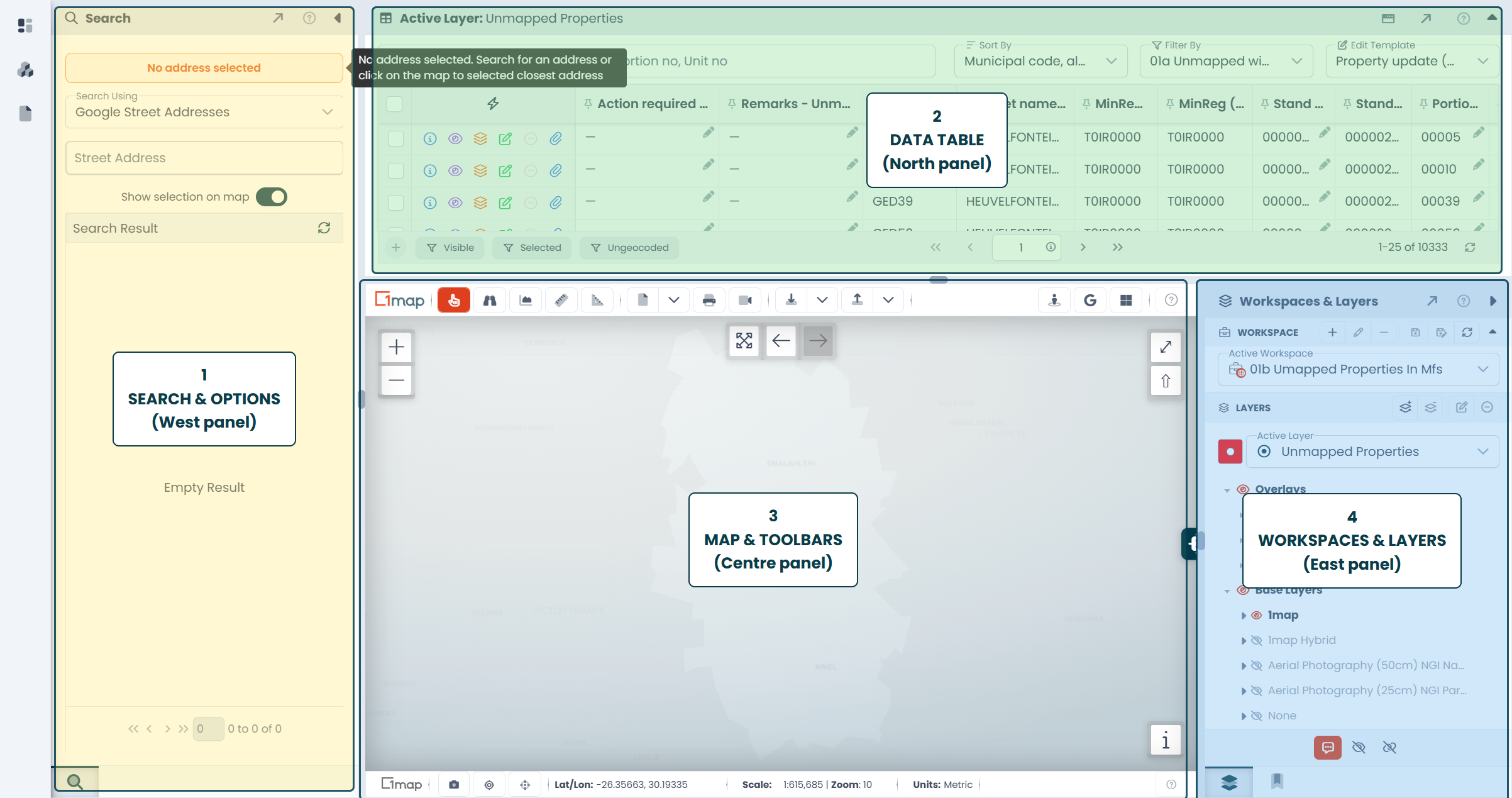
The Four Panels
| Panel | Position | Purpose | |
|---|---|---|---|
| 1 | Search & Options | West / Left | Search for addresses and places, plus any extra tools your deployment provides |
| 2 | Data Table | North / Top | View and edit attribute data for the active layer |
| 3 | Map | Centre | Interactive map with toolbars for navigation, measurement, and analysis |
| 4 | Workspaces & Layers | East / Right | Manage workspaces, layers, bookmarks, and georeferenced images |
Resizing Panels
All panels are separated by drag handles (gutters). Drag a gutter to resize adjacent panels.
Collapsing Panels
Each panel can be collapsed by clicking the caret icon in its header, or by dragging its gutter all the way to the edge. When collapsed on desktop, a thin strip with a rotated label shows what panel is hidden — click it to expand again.
Undocking Panels
Most panel tabs — the Data Table, Workspaces & Layers, Bookmarks, Search, and others — can be undocked into floating dialogs by clicking their undock button (). Undocked dialogs are resizable, draggable, and can be maximised to full screen. Click the dock button on the dialog to return the panel to its place.
Top Navigation Bar
The bar at the very top of the screen is always available, on the dashboard and inside the application:
| Element | Description |
|---|---|
| Menu () | Opens the navigation sidebar with links to the areas you have access to |
| Logo | Your service provider's logo |
| Help | Help resources and documentation |
| Theme toggle (/) | Switch between the Light and Dark theme |
| Your avatar / name | Opens the Profile Options panel — switch accounts, open your profile, or sign out |
| Status light | A small dot showing the connection to the server — green means connected |
Some deployments add more items, such as a quick language selector.
Top Toolbar
The top toolbar of the map panel contains all the map interaction tools: pointer, measurement, printing, export, and more. These are covered in detail in the Map Tools section.
Bottom Toolbar
The bottom toolbar provides snapshot function, your Geolocation and zoom to Coordinates, Latitude / Longitude, current scale and zoom level and whether in metric or imperial units. These are covered in detail in the Map Tools section.