Appearance
Map Navigation
The map occupies the centre panel of the application. You can pan, zoom (5 methods), and rotate the map using your mouse, keyboard, or the on-screen controls.

Panning
- Click and drag the map to pan in any direction
- On touch devices, use a single-finger drag
Zooming
There are several ways to zoom:
| Method | Action |
|---|---|
| Mouse scroll | Scroll up to zoom in, scroll down to zoom out |
| Double-click | Double-click on the map to zoom in one level |
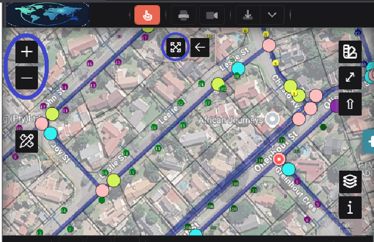
| Zoom buttons | Click the + or − buttons on the left side of the map (circled in image above) |
| Full Extent | Click the expand button () to zoom to the full extent of your data (circled in image above) |
| Keyboard | Use Shift + Drag to draw a box and zoom to that area |
Rotate
- Alt + Shift + Drag to rotate the map
- Click the compass indicator (top-right area) to reset rotation to north
Extent History
Navigate through your recent map views:
- Previous Extent () — go back to your previous map position
- Next Extent () — go forward after navigating back
These buttons are located with the floating map controls.
Geolocation
Click the Geolocation button () in the bottom toolbar to centre the map on your current location. Your browser will ask for permission to access your location the first time you use this.
Zoom to Coordinates
Click the Zoom to Coordinates button in the bottom toolbar to enter specific coordinates and navigate directly to that location.
Fullscreen
Click the Fullscreen button () in the floating controls to expand the map to fill your entire screen. Press Escape or click the button again to exit fullscreen.
Scale and Coordinates
The bottom toolbar displays real-time information:
| Element | Description |
|---|---|
| Lat/Lon | Current cursor position in latitude/longitude |
| Scale | Current map scale (e.g. 1:5000) |
| Units | Measurement unit system (Metric or Imperial) |
Right-Click Menu
Right-click anywhere on the map to access a context menu with:
| Option | Description |
|---|---|
| Centre Map Here | Pan the map to centre on the clicked point |
| Download view as PNG | Save the current map view as an image file |
| Copy Coordinates (Lat,Lon) | Copy the clicked point's coordinates to your clipboard |
| Zoom to Full Extent | Zoom out to the full extent of the map |
| Zoom In / Out | Zoom in or out one level at the clicked point |
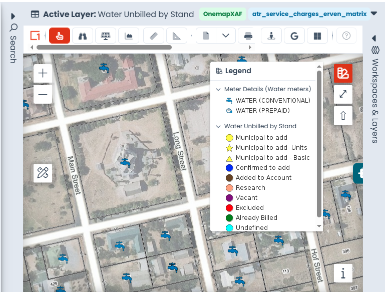
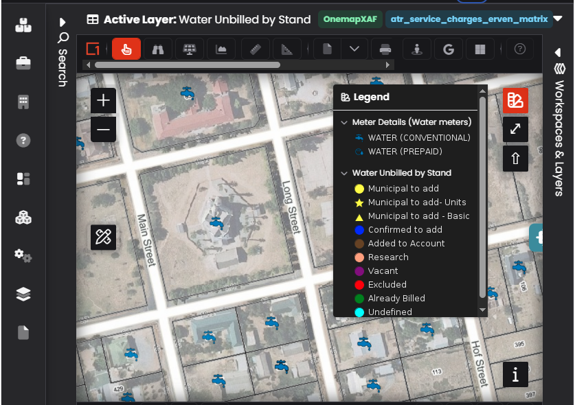
Legend
Click the Legend button () in the floating controls to show or hide the map legend. The legend displays symbols and colours for all visible layers.